
Ouachita
Note: This is part of the newest newsletter. Subscribers got a little more post, and they found out about it sooner.
Speaking of things that change over time, and things that don’t, I just got back from The Ouachita Mountains. I wish I were better at landscape photography, instead of pictures of old shoes and lost toys, but I did see some rocks.
I love rocks. We don’t get a lot of rocks here. Sure, we get a lot of gravel that’s been washed around for millions of years, and we get some sandstone in places, but there’s not a lot of places to see amazing rocks in mid-Mississippi.
The orogeny of the Ouachitas is somewhat unknown, though it’s thought to involve the crashing together of the North and South American plates some 250 million years ago. Not that North and South America existed at this time. This is around the same time that sturgeons, paddlefish, and the first frogs evolve. The first dinosaurs are about 25 million years away. This is before Laurentia joined the forming Pangaea. The Ouachitas and Appalachians are older than Pangaea. Older than dinosaurs.
In ages past, the Ouachitas likely intersected with the Appalachians. But during the strange breakings and rumblings of the breakup of Pangea, the eastern half of the range became buried by something called the Mississippi Embayment. The exact method by which the landmass between Arkansas and Alabama became an ocean is unknown, though it’s thought to have something to do with the New Madrid Seismic zone and the Reelfoot Rift. I like the Mississippi Embayment. I like the idea that Mississippi has been underwater and a swamp and a problem for hundreds of millions of years.
People sometimes confuse the Ouachitas with the Ozark Mountains, which are older than the Ouachitas or the Appalachians. The Ozarks were probably a billion years old when the Appalachians first were pushed up, but that’s a story for another time.
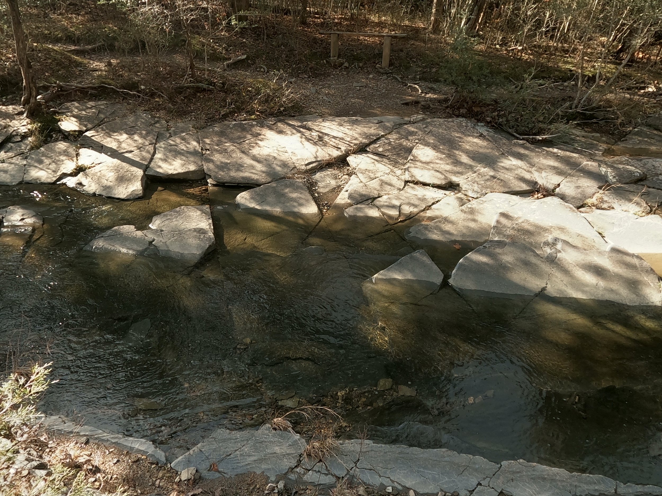
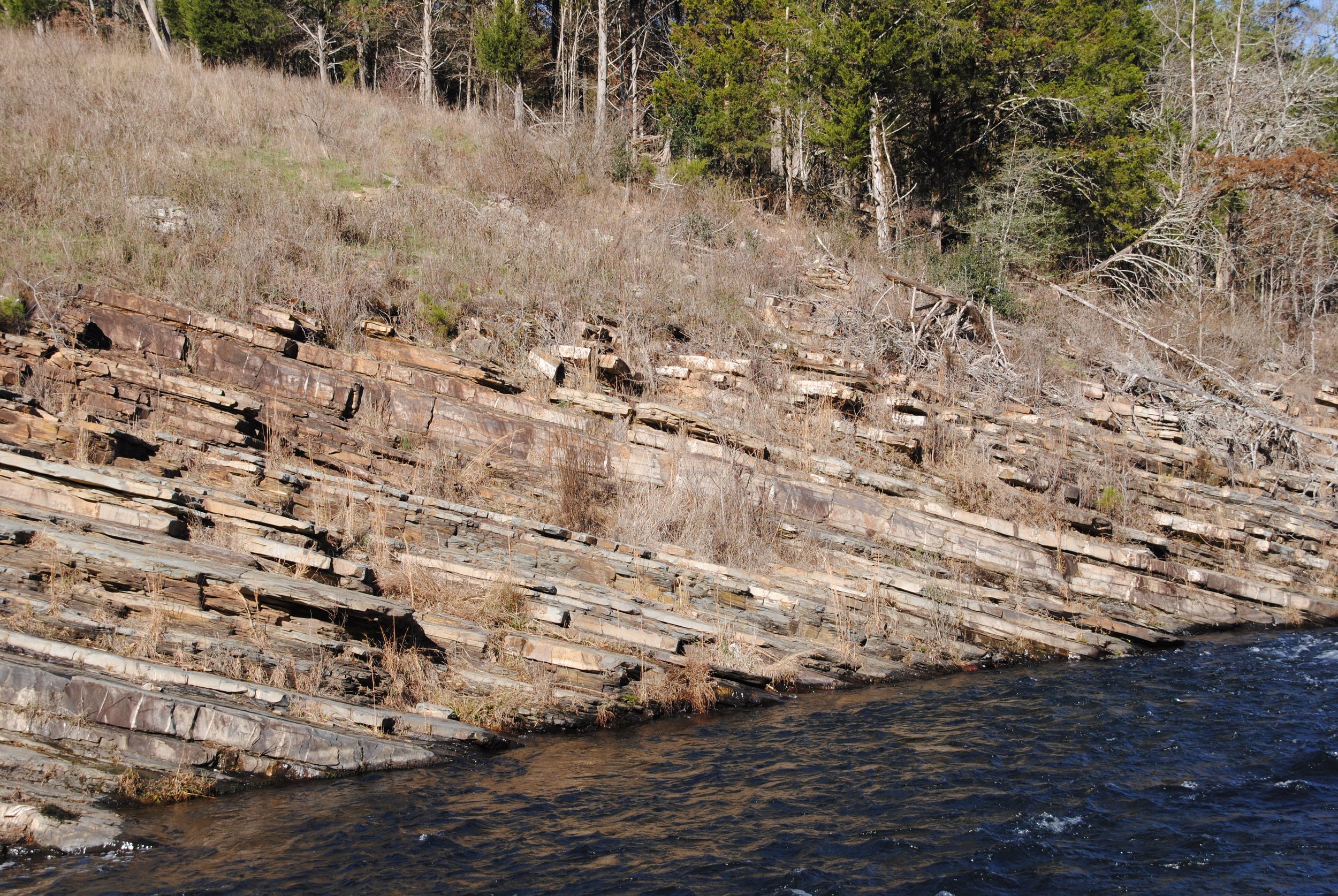
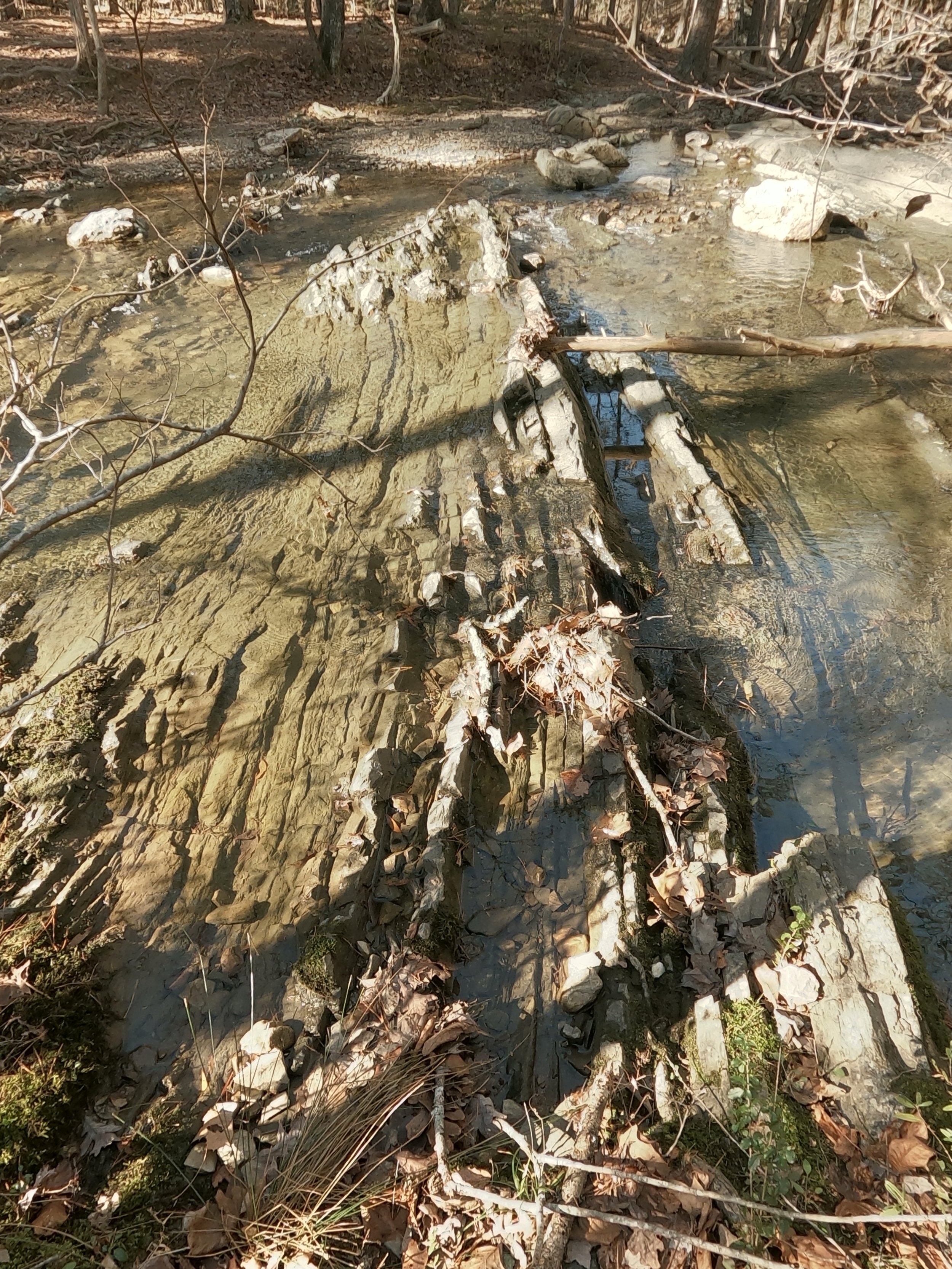
The Ouachitas are famous for quartz veins. The reason that the Ouachitas are famous for quartz veins is their immense age and possibly, the Mississippi Embayment. You see, shale, the rock which forms most of the mountains I was in, forms in sheets that lay perpendicular to the ground, but the tectonic forces that push up mountains tend to bend it into huge sheets, like a rug being bunched up. Shale cracks in regular patterns that cross the planes of sheets, creating “veins.”
slate fracturing geometrically
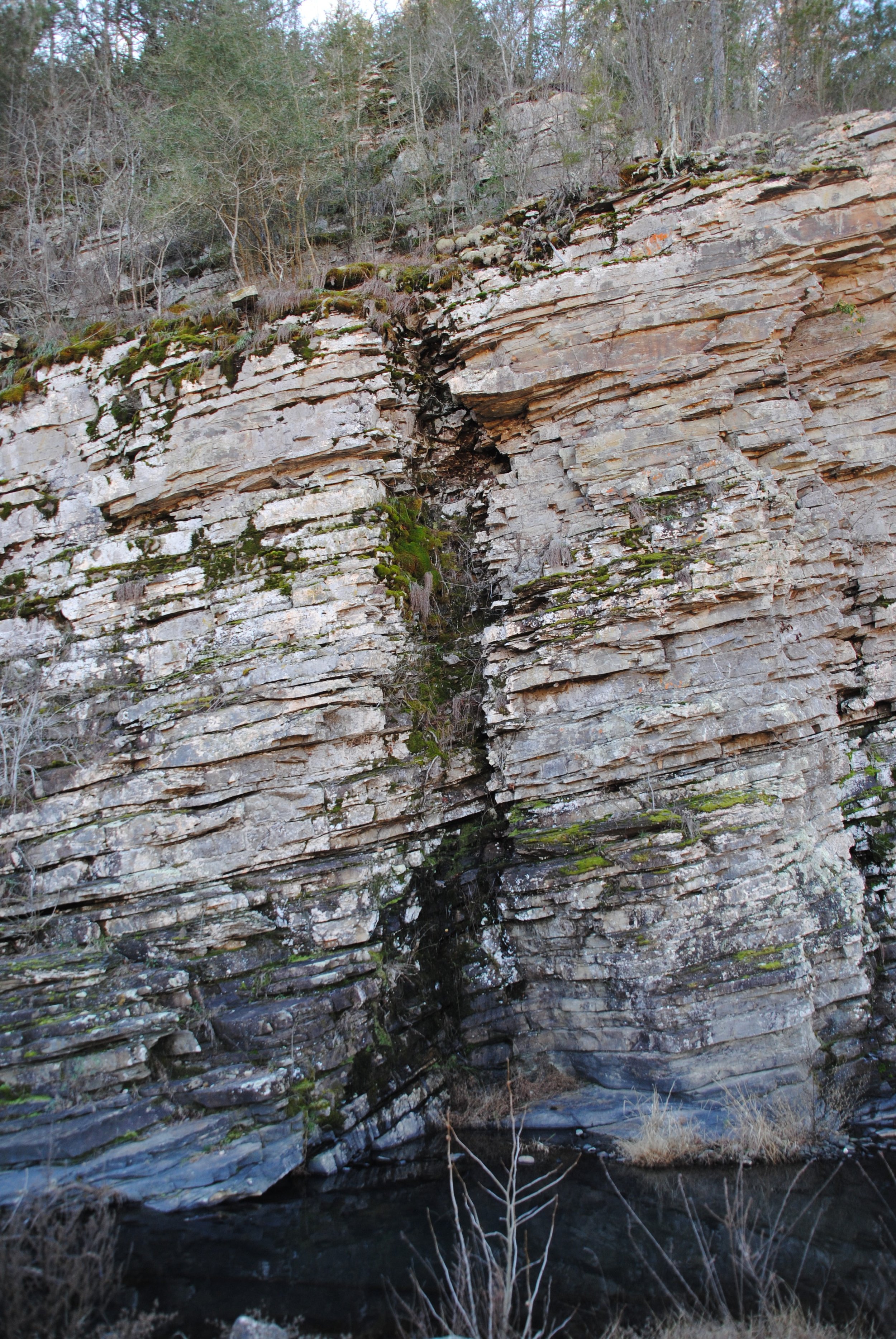
And over time, fluid from deeper beneath the earth is worked into these spaces, and very slowly, quartz crystals form in the gaps.
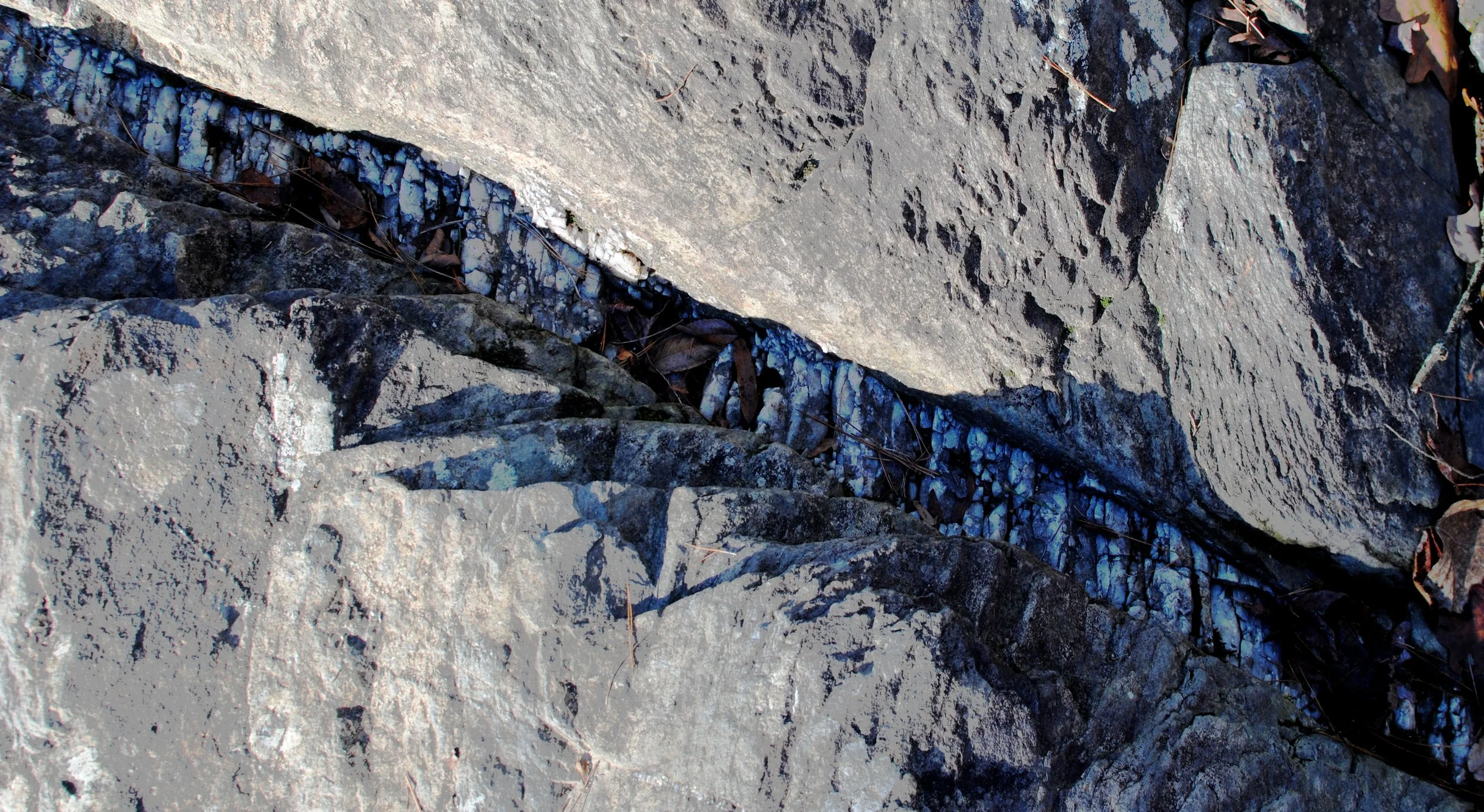
A quartz vein visible between two slabs of stanley shale
These are visible at the surface in many places, both the sheets of shale and the veins of quartz within them.
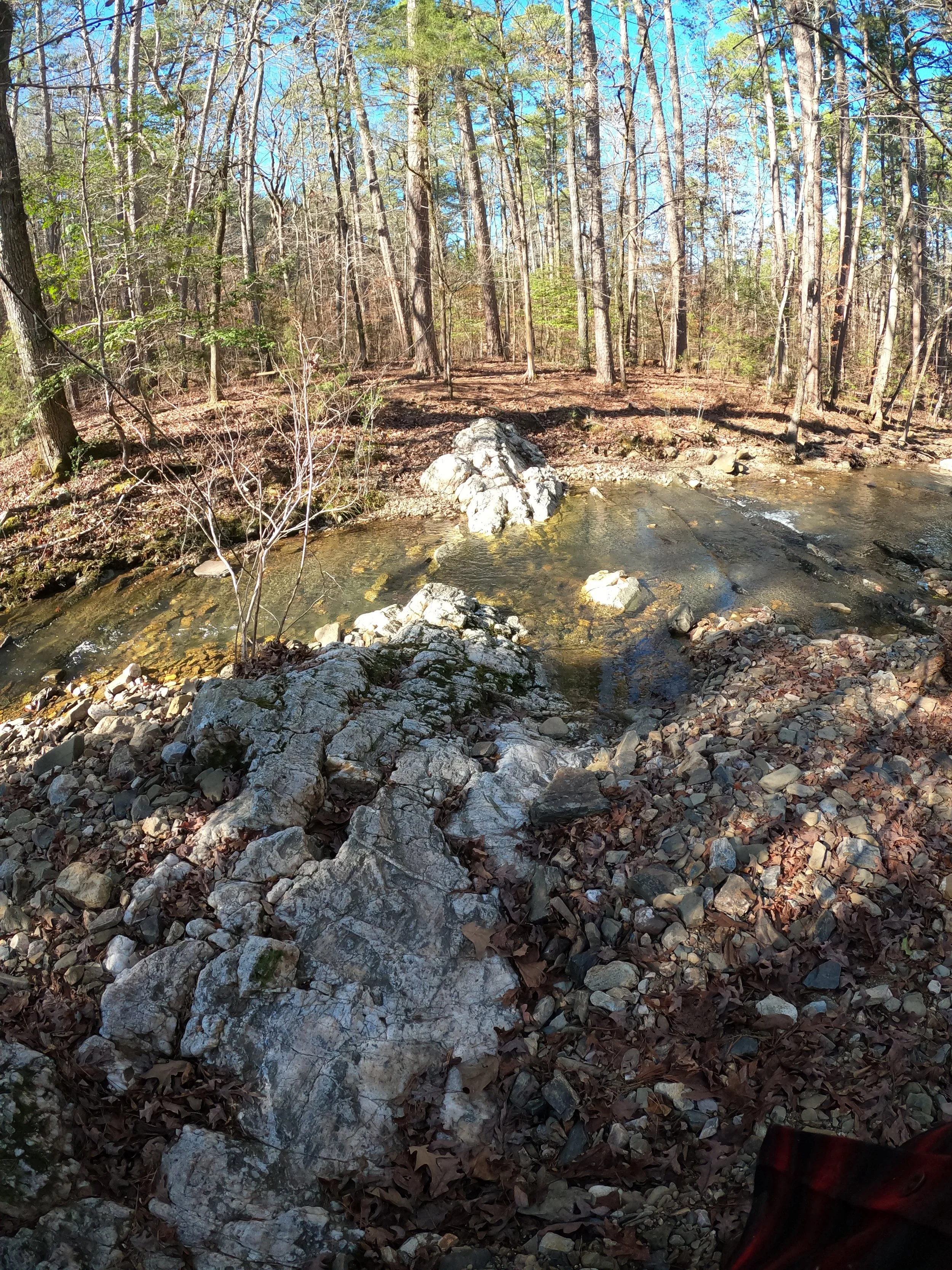
A much larger vein of quartz
As these rocks are eroded - and they are, the Stanley Shale of the area is not a particularly hard stone, the ancient bends of the Earth are revealed, the motions that spread sturgeons to Russia and Oklahoma before ants existed, leave their tracks.
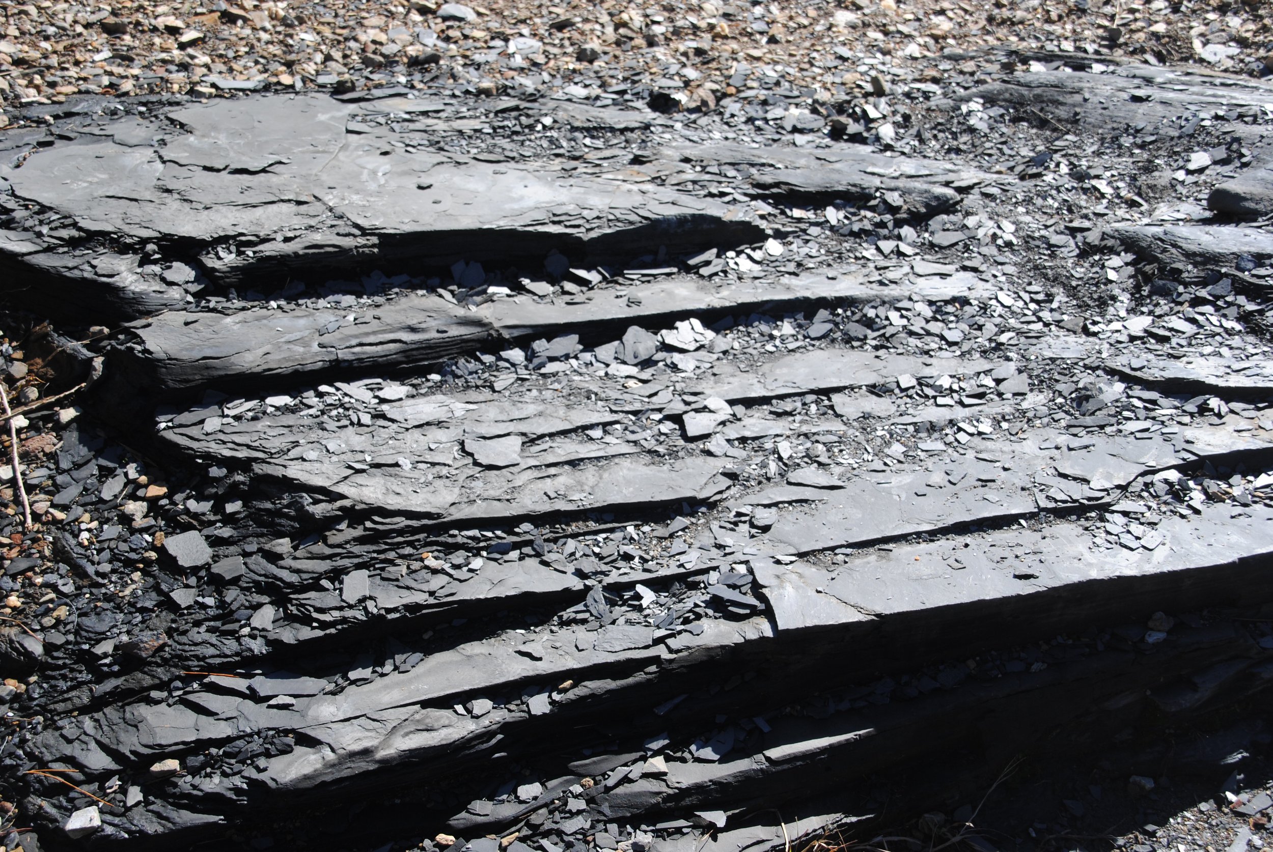
The thin layers of shale
At Beaver Bend (which is named after a fellow named Beaver, but also contains beavers) you can see it in the jutting angles of the underlying shale.
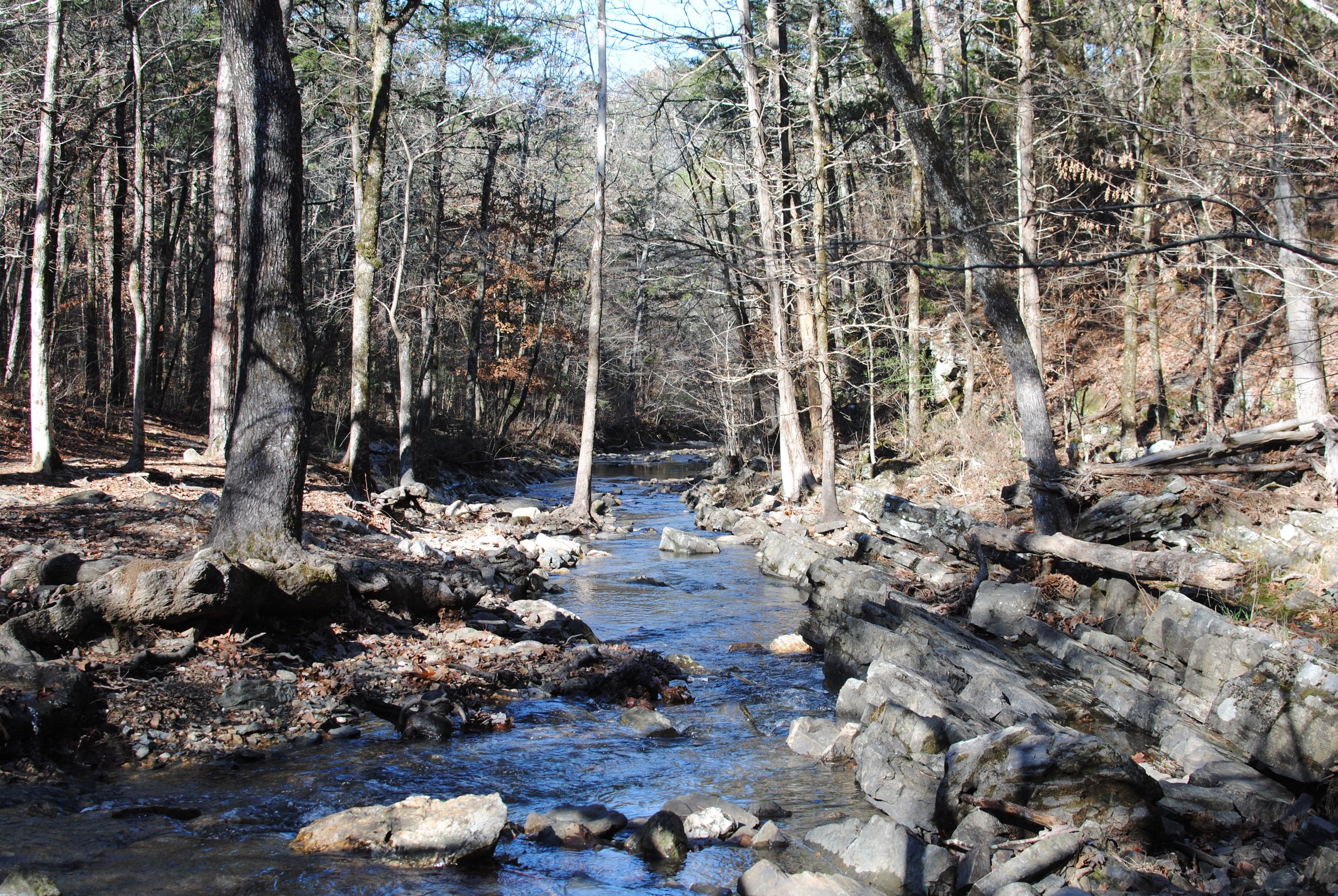
Having lived my whole life in the silt and sands, the paths of these mountain streams and rivers fascinate me. A small mountain stream could easily continue in the same bed for thousands of years. Millions of years. The big sandy rivers and streams I know often change courses several times in a human lifetime.
It’s that time of year when it’s easy to think about change - big or small, fast or slow. Many cultures have a celebration this time of year. It’s a bleak time - the nights have been getting longer and longer, and the coldest days are still ahead, but right now, those who watch the skies wisely will notice the smallest of hopes - the days stop getting shorter, there is now just a little bit more light.